


I set out from Taba Heights just after breakfast, with the mountains on one side, the Gulf of Aqaba on the other, and the feeling that this narrow strip of Sinai coast still hides more history than its quiet hotels and empty beaches suggest. By the time my small boat turned toward Pharaoh’s Island, the day had become not only a coastal excursion but a walk through the layered story of a medieval fortress that once watched over some of the busiest trade routes in the region.
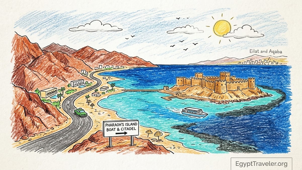
Following the Narrow Road Between Mountains and Sea
The day began with a short transfer from my hotel at Taba Heights, a self-contained resort area about 20 kilometers south of the Taba border. The asphalt road threaded a tight corridor between rust-red granite mountains and the hard blue sheet of the Gulf of Aqaba. The coastal shelf here is so narrow that the carriageway, power lines, and scattered hotel compounds all compete for the same slim strip of flat land before the terrain pitches straight up into rock.
Even before reaching the marina, the geopolitical jigsaw of the upper gulf was obvious. Across the water, the low-rise spread of Eilat in Israel formed a bright band on the far shore, while farther to the left, the port cranes and hotel towers of Aqaba in Jordan rose from the haze. Somewhere beyond the mountains to the south lay Saudi Arabia. From the road it felt almost implausible that four different national coastlines could converge around a body of water barely 25 kilometers across, yet the arrangement is purely geographic rather than symbolic, dictated by the way the Sinai Peninsula pinches the gulf into a long, narrow trench.
My driver dropped me at the small marina that serves Taba Heights, little more than a pier, a cluster of speedboats and day-cruise vessels, and a kiosk sheltering from the morning sun. I had reserved a place the previous evening through the hotel activities desk on a combined glass-bottom boat and island visit run by Aquatic World, one of the local operators that still advertise short cruises out to Pharaoh’s Island. Their board in the lobby listed two-hour cruises that circle the island and three- to five-hour snorkeling trips that include a landing; I opted for the version that actually steps ashore.
Check-in was informal but organized. A staff member confirmed my name, copied my passport details, and checked that I had the separate monument ticket for the fortress itself, which is sold under the Ministry of Tourism and Antiquities pricing scheme as “Salah al-Din Citadel (Taba).” For foreign adults, the official 2026 rate is 400 Egyptian pounds, with 200 for foreign students and far lower rates for Egyptian visitors. Entrance hours are listed as 9 a.m. to 5 p.m., matching the current national table for archaeological sites in Sinai, and the staff were careful to remind us that the boat had to respect both weather and closing time.
Crossing the Short Stretch to Pharaoh’s Island
By 9 a.m. we were easing away from the dock on a medium-sized motor boat fitted with a glass panel in the hull. There were just over a dozen passengers on board, a mix of Europeans staying at Taba Heights and a small Egyptian family from Cairo who had come up the coast for the weekend. A crew of three handled everything: navigation, safety briefing, and the inevitable offer of tea or soft drinks from a simple cooler in the stern.
The distance from the mainland to Pharaoh’s Island is short in absolute terms, roughly 240 to 250 meters off the Sinai coast, but the crossing from Taba Heights is longer because the marina sits up the shoreline and we had to follow a gentle arc south, parallel to the land, before cutting toward the island itself. The crew estimated the total cruising time at about 30 minutes each way. The sea that morning was modestly choppy, with low whitecaps but no serious swell, and visibility through the glass panel was good enough to watch ribbons of coral, sand gullies, and darting fish slide under the boat as we motored along.
Officially Pharaoh’s Island is also known as Coral Island, and from the water the reason is clear. The granite rock of the island itself rises out of a pale turquoise apron that darkens sharply where the reef wall drops away. Our captain slowed down as we approached, partly to avoid running too close to the coral, partly to give everyone time to photograph the fortress that crowns the island’s northern hill. Unlike the lone tower some brochures still show, the structure is unmistakable as a full-scale medieval complex, with a stout northern keep, perimeter walls stepping down the slope, and traces of secondary bastions on a lower southern rise.
We transferred to the island at a small jetty that hugs the more sheltered side of the rock. There is no road or causeway here; every visitor still arrives by sea. A uniformed guard from the antiquities authority checked our monument tickets just beyond the landing, under a shade awning with a simple signboard listing the 9 a.m. to 5 p.m. opening hours, and we stepped onto a stone path that begins the climb up toward the northern fortress.
Walking Into Salah al-Din’s Fortress Above the Gulf
From the landing jetty, the route onto Pharaoh’s Island is a short but steep ascent. The path is mostly stone steps, some original, some clearly rebuilt with regular modern blocks. The outer curtain wall of the northern fortification comes into view almost immediately, a run of honey-colored masonry edged by simple crenellations. Archaeological descriptions of the island make it clear that the castle is organized into two principal sections, a northern and a southern fortification, separated by a central saddle that once held storerooms, living quarters, and a small mosque. On the ground, this layout is surprisingly easy to read.
We entered first through a restored gateway into the northern complex, believed to have owed its current form to the late 12th-century rebuilding associated with Salah al-Din’s Ayyubid dynasty. Much of what stands has been re-pointed and stabilized in recent decades, and in places whole segments have been reconstructed, but the plan follows the medieval blueprint. Narrow passages spur off to roofless rooms that would have housed soldiers and supplies, and a small internal courtyard opens toward a cistern that tapped into the island’s precious freshwater collection system.
Our guide, one of the crew who had switched seamlessly into storytelling mode, kept a careful distinction between what the academic record supports and what later tourism slogans have embroidered. It is documented that the island, which had earlier Byzantine structures, was fortified by Crusader ruler Baldwin I in the early 12th century to control pilgrim and trade traffic through the gulf, and that Salah al-Din’s forces later reworked it as part of a defensive chain protecting routes between Egypt, Syria, and the Hejaz. What is not substantiated are some of the more dramatic tales of hidden tunnels running under the seabed or secret dungeons used as long-term prisons; these, he admitted with a half smile, belong more to postcards than to excavation reports.
Climbing onto the northern ramparts, I could feel the difference between original and restored fabric underfoot. Some stretches retain irregular, weathered blocks that bear chisel scars and erosion consistent with centuries of exposure, while other sections stand almost too neat, with sharp-edged stones and mortar that still looks relatively young. From the parapet, the practical logic of the site becomes obvious: catapult range over the shipping lane, commanding views down the gulf, and walls braced against attack from the sea-facing side while the inner slopes fall away steeply behind.
Crossing the Saddle to the Southern Works and the Viewpoints
Leaving the northern keep, a slightly lower path leads across the central saddle of the island. Here, low foundation lines trace out what would once have been storage buildings and perhaps the small mosque mentioned in heritage submissions for the site. Most of these remain in archaeological outline rather than full reconstruction: waist-high stone courses, door thresholds leading to open air, and a rectangular depression that likely marks a former courtyard. The decision not to rebuild these completely gives this middle space a more ruin-like character, which contrasts with the cleaned and consolidated towers on either side.
On the southern rise, fortifications are less massive but still clearly military in purpose. The walls here are thinner, and some stonework appears older, possibly preserving elements from the Crusader phase or even incorporating reused blocks from Byzantine-period structures that earlier scholars noted on the island’s southern hills. There is a small bastion that projects toward the gulf, its firing positions now serving as one of the island’s best viewing terraces. Metal safety rails have been added in recent years, not entirely subtle but welcome when a gust of wind barrels up the side of the rock.
The viewpoint from this southern side offers one of the most striking panoramas on the Gulf of Aqaba. To the northwest, the Egyptian coast runs back toward Taba town, a thin band of pale shore beneath serrated brown ridges. Pivoting clockwise, the Israeli city of Eilat spreads along the opposite bank, its hotel towers and marina clearly visible. Beyond that, the Jordanian shoreline around Aqaba arcs out of the haze, with port infrastructure and newer high-rise blocks as recognizable markers. On exceptionally clear days, the far Saudi coast frames the deeper southern horizon, though atmospheric conditions often leave it as a suggestion rather than a sharp line. The claim that four countries can be seen from a single vantage point is broadly true, but it depends very much on the weather and the eye.
Standing there, it is easy to understand why a succession of powers invested in this outcrop of granite. Medieval ships entering the upper gulf would have had little chance of avoiding notice. Even today, small freighters, ferries, and fast-moving tour boats draw lines across the water below, and the modern border checkpoints at Taba and Eilat sit within the field of view once scanned by lookouts whose concerns were caravans, not customs lines.
Time on the Island: History, Logistics and Limitations
Our boat schedule allowed just over an hour on Pharaoh’s Island. That proved enough for a full circuit through the main fortress spaces, though anyone with a strong interest in military architecture or photography could easily spend longer using the small shade pockets along the walls as temporary bases. Aside from a basic restroom block close to the landing point and a modest kiosk selling bottled water and soft drinks when staff are present, there are virtually no facilities on the island. The absence of a café or souvenir shop may disappoint some visitors but does help preserve the site’s relatively quiet atmosphere.
In practical terms, the fortress is a straightforward visit but not a casual stroll. The stone steps are uneven, some without railings, and almost everything is exposed to the elements. In late spring and summer the reflected heat from the rock can be intense by midday, which is why many local guides recommend morning departures from Taba Heights or from the shoreline hotels nearer Taba town. The Ministry’s current opening window of 9 a.m. to 5 p.m. fits comfortably with these timings, but high winds or rough sea conditions can still cancel or shorten crossings even when the ticket office is technically open.
The financial side of the excursion breaks into two parts: the monument entrance ticket and the boat service itself. As of late 2026, foreign adults pay about 400 Egyptian pounds for entry to Salah al-Din’s citadel on Pharaoh’s Island, with half that for foreign students holding valid identification. Egyptians and Egyptian students pay significantly less. The boat price varies by operator, season, and whether snorkeling equipment and lunch are included; older group price lists from local agencies quote around 40 to 50 US dollars for a Friday or Sunday boat trip including basic refreshments, and recent hotel desks in Taba Heights still use similar ballpark figures, adjusted for current exchange rates.
One limitation is that there is no regular public ferry to the island. Every visit must be arranged through a local operator, hotel activity desk, or independent skipper with the necessary permissions to land passengers at the monument jetty. During quieter months, some smaller operators reduce or pause their schedules, so travelers arriving independently from Nuweiba or farther south should not assume they can simply appear on the Taba shoreline and find a boat waiting. Calling ahead through a Taba Heights hotel or a known operator such as Aquatic World remains the most reliable approach.
From Fortress to Fjord Bay Along the Empty Road
By late morning we were back at the marina, salt-dried and slightly dazzled from the brightness on the stone. After a brief stop at the hotel to refill water bottles and change into swimwear, I arranged a taxi south to Fjord Bay, another of the Taba area’s headline natural sights. The driver quoted a fare consistent with other recent visitor reports for the roughly 20- to 25-kilometer journey from Taba Heights down the coast road, and we set off once more along the strip between mountain and sea.
Traffic remained thin, limited to the occasional minibus, a couple of long-distance coaches on the route to Nuweiba, and a few private cars. On the right, the gulf repeated itself in bands of deep blue and aquamarine. On the left, the granitic ridges of Sinai rose in stacked layers of rubble and cliff, already pinkening toward the mid-afternoon light. Police and military checkpoints punctuated the journey, standard on main routes in Sinai, and the driver handled the brief document inspections with practiced ease.
Fjord Bay announced itself not with a town sign but with a sudden, theatrical curve of coastline. From the road, the land folds inward to form a deep, almost circular bay cradled between two rocky spurs. Local tourism materials routinely refer to it as a “fjord,” but this is a descriptive borrowing rather than a geological label. True fjords are carved by glacial glaciers; here there is no such history. Instead, the bay is the outcome of marine erosion and tectonic shaping in a rift environment, where the steep desert mountains descend sharply into the Red Sea system.
There are two distinct experiences at Fjord Bay. The first is the high roadside viewpoint, which appears as a small gravel lay-by above a sweeping S-bend in the road. Several cars and a minibus were already parked there when we arrived. From this vantage point, the bay takes on the classic shape seen in countless travel photographs: an oval of unusually deep blue water nested in lighter shallows, ringed by bare hills, with the dark line of the reef visible beneath the surface. The driver gave me twenty minutes to wander along the verge, find safe footing, and take in the scene before we dropped down closer to the water.
Understanding Fjord Bay: Viewpoint, Beach and Water
After the roadside stop, we continued down a short spur that leads toward sea level. Actual access to the shore is not guaranteed simply because you can see the water from the road. Parts of the beachfront around Fjord Bay are managed by private camps or small concessionaires, some of which open on a seasonal basis. On my visit, one such operator had a simple entrance gate, a hand-painted sign in Arabic and English, and a list of charges for day visitors: a modest fee for access to the beach itself, with additional costs for the use of sun loungers, umbrellas, and basic snorkeling equipment.
The infrastructure here is rudimentary but sufficient for a half-day stop. A few rows of plastic loungers lined the sand, and a makeshift snack bar served bottled water, soft drinks, tea, and packets of chips. Showers, where present, were cold tap heads rigged to a tank, and there were basic toilets in a concrete block behind the main shade structure. Payment was cash only, which matches broader advice for this stretch of coast between Taba and Nuweiba; there are no banks or ATMs in the immediate area, and mobile coverage, while generally present, should not be relied upon for electronic payments.
I limited my own time in the water to a short swim from the shore, keeping to the sandy entry area where a beaten path avoids the worst of the coral fragments and sea urchins that people warn about. The bay’s appeal for snorkelers and divers lies in the steep drop-off not far from shore, where the bottom shifts from pale sand to a darker, coral-rich slope. Several independent dive centers in Sinai mention Fjord Bay among their shore or boat dive options, praising the clear water and fish life. Even from the surface, with only a mask and snorkel, it was possible to glimpse small reef fish flaring against the blue as the ground fell away beneath me.
Back on land, the difference between the roadside viewpoint and the managed beach felt significant. The high lay-by delivers the iconic photograph and a broad sense of the bay’s shape within the wider Gulf of Aqaba. The beach concession offers something more intimate and sensory: the crunch of coarse sand, the smell of sun-warmed saltwater, the muffled sounds of other swimmers, and the quiet presence of the mountains that hem everything in. Both experiences share the same geological story, but they serve different moods, and travelers with limited time can tailor their stop accordingly.
Logistics from Dahab and Northern Sinai
The practical question for many visitors is whether Taba’s pair of signature sights Pharaoh’s Island with its Salah al-Din fortress and Fjord Bay with its landlocked curve of water justify a dedicated journey from farther south, particularly Dahab, or fit better as side trips while already staying in the northern Sinai region. My day began and ended at Taba Heights, which made the logistics straightforward: a morning boat excursion to the island, a midday rest, and an afternoon taxi to Fjord Bay all within a 40-kilometer radius.
For those starting in Dahab, the equation is more demanding. The coastal road between Dahab and Taba runs via Nuweiba and covers roughly 150 to 180 kilometers depending on exact starting point, with multiple security checkpoints that add time. Minibuses and private transfers link Dahab to Nuweiba and Taba, but scheduled services can be sparse outside peak holiday periods, and departures are often early in the morning. A same-day round trip from Dahab to Taba, including the island visit and a meaningful stop at Fjord Bay, would be long and tiring, leaving little margin for delays or weather disruptions.
A more comfortable pattern, reflected in the itineraries of several Egypt-focused tour companies, is to treat Taba as a northern base within a broader Sinai circuit. Travelers tracing a route from Sharm el Sheikh or Dahab up to the Israeli or Jordanian borders, or those planning to cross into Eilat or Aqaba, can pause for one or two nights in Taba or Taba Heights. From there, Pharaoh’s Island and Fjord Bay become half-day or day-length excursions instead of endpoints at the far end of a marathon journey. This rhythm also allows for some flexibility if wind on the gulf forces boat operators to shift island departures by a day.
Costs, too, look different when spread over a multi-night stay. The combined outlay for the island monument ticket, boat excursion, and taxi or car hire to Fjord Bay is modest compared with long-distance private transport from Dahab. Balancing budget against time, many independent travelers conclude that if their route already brings them to northern Sinai, then folding in Taba’s historical and coastal sights is eminently worthwhile. If, on the other hand, Dahab is their only Red Sea base and they have no plan to travel farther north, the appeal of Taba must compete against closer excursions such as the Blue Hole, the Canyon, or day trips into the desert behind Dahab.
The Takeaway
By the time I returned to Taba Heights in the late afternoon, the sun had started to drop behind the spine of the Sinai mountains, casting long shadows over the resort lawns and turning the gulf a deeper shade of indigo. My day had contained little of the bustle that often defines Egyptian travel no crowded bazaars, no city traffic, no sequence of interior monuments but it had sketched a compact portrait of how history and geography intersect at this northern tip of the Red Sea.
Pharaoh’s Island, with its two-part fortress and multi-layered past, felt more substantial than some of the brochure images had led me to expect. Walking through the northern and southern works, reading the plan of the castle in the stone, and looking out over the meeting point of modern states gave the site a grounded reality that outstripped the marketing clichés about secret tunnels and distant crusaders. Seeing where the original masonry ends and modern restoration begins brought an honest appreciation of how much effort goes into keeping such a windswept outpost standing at all.
Fjord Bay, for its part, proved that the loose use of the word “fjord” hides a more interesting narrative about rift geology and coastal shapes. From above, it is a photograph waiting to happen; from the beach, it is a sheltered pause in a harsh desert coastline, welcoming enough to invite a swim or snorkel but still raw around the edges. The separation between the roadside viewpoint and the privately managed beach made clear how travelers need to think in practical steps: where to park, whether to pay an access fee, how to handle basic services like water and shade.
If I had been in Dahab with only a few days to spare, I might have hesitated to commit the time and logistics required for a standalone dash to Taba. Yet as part of a stay in northern Sinai, the combination of Salah al-Din’s island fortress and the sweep of Fjord Bay felt entirely worth the effort. It was the contrast that sealed it: medieval walls on a rock barely 250 meters offshore, watching a modern four-country horizon, followed by an inlet whose deceptive name disguises a very real beauty. For travelers already tracing the upper gulf, setting aside a day to step onto Pharaoh’s Island and lean over the guard rail above Fjord Bay is a decision that rewards both curiosity and patience.
FAQ
Q1. Where is Pharaoh’s Island in relation to Taba?
Pharaoh’s Island lies a short distance offshore in the Gulf of Aqaba, roughly a few hundred meters from the Sinai coast and about 8 kilometers south of Taba town, reached only by boat.
Q2. Are the Salah al-Din fortress opening hours really 9 a.m. to 5 p.m.?
Current official tables for Egyptian archaeological sites list the Salah al-Din citadel on Pharaoh’s Island as open from 9 a.m. to 5 p.m., though boat departures still depend on weather and operator schedules.
Q3. How much does it cost to visit the fortress on Pharaoh’s Island?
The Ministry of Tourism and Antiquities lists the 2026 ticket price at about 400 Egyptian pounds for foreign adults, 200 for foreign students, with significantly lower rates for Egyptians and Egyptian students.
Q4. Can I reach Pharaoh’s Island without joining a tour?
There is no public ferry, so you must arrange a boat through a local operator, hotel activities desk, or licensed skipper; independent land access is impossible because the island is offshore.
Q5. What is the actual layout of the Salah al-Din fortress?
Instead of a single tower, the fortress is a full medieval complex with separate northern and southern defensive sections, linked by a central area that once held storerooms, rooms, and a small mosque.
Q6. Is it really possible to see four countries from the island?
On clear days you can usually see the Egyptian coast, Israel around Eilat, and Jordan near Aqaba, and sometimes the more distant Saudi shoreline, though visibility varies with haze and light.
Q7. Why is Fjord Bay called a “fjord” if it is not glacial?
The name is descriptive rather than scientific; the bay’s deep, narrow shape resembles a fjord, but it was formed by tectonic and marine erosion processes, not by glaciers.
Q8. What is the difference between the Fjord Bay viewpoint and the beach?
The roadside viewpoint is a free lay-by high above the bay that offers the classic wide panorama, while actual beach access is lower down and may be managed by private camps that charge day-use fees.
Q9. Does it make sense to visit Taba on a day trip from Dahab?
A same-day return from Dahab is technically possible but long and tiring; many travelers find it more sensible to stay one or two nights in Taba or Taba Heights and visit Pharaoh’s Island and Fjord Bay from there.
Q10. Are swimming and snorkeling recommended at Fjord Bay and around Pharaoh’s Island?
Both locations are known for clear water and reefs, and snorkeling is commonly offered by boat operators and beach camps, but visitors should use proper gear, avoid stepping on coral, and follow local safety advice.