


Egypt’s Gulf of Aqaba coast feels like a world apart from the Nile Valley. Snow–tipped granite peaks plunge straight into translucent water, Bedouin camps line pale sand bays, and small towns like Dahab and Nuweiba still move at a slower, salt–streaked pace. This road trip itinerary traces that shoreline from Sharm el Sheikh Airport to Dahab, Nuweiba and Taba, with optional extensions, focusing on protected areas, desert–by–sea scenery and Bedouin communities rather than the classic Cairo and Luxor circuit.
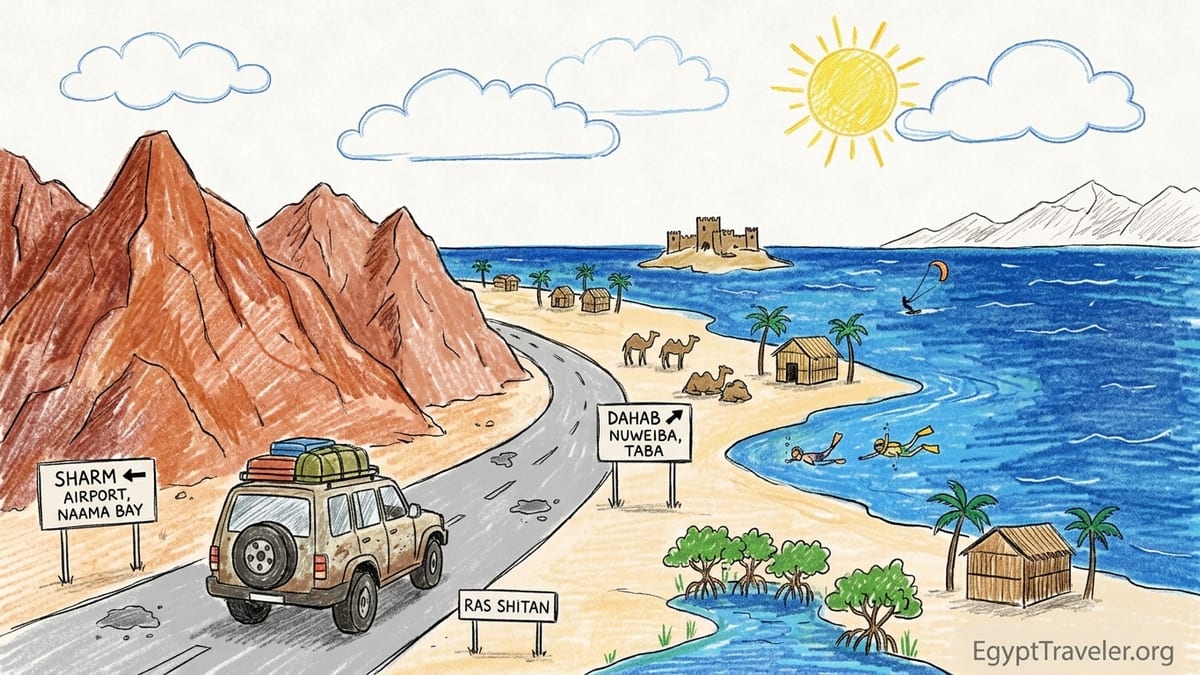
Planning a South Sinai Coastal Road Trip
South Sinai’s main tourist corridor runs along the coastal highway that links Sharm el Sheikh, Dahab, Nuweiba and Taba beside the Gulf of Aqaba. Once you leave the hotel strips, it quickly becomes a road of big horizons: mountains on one side, sea on the other, with long gaps between fuel stations and villages. The other major paved axis runs inland from the coast to St Catherine in the high mountains, but this itinerary keeps you near the water, where snorkeling coves and Bedouin camps are the stars.
Security checkpoints are a constant of travel in South Sinai. Expect police and army posts on the way out of Sharm, between Sharm and Dahab, north of Dahab toward Nuweiba, and again on the final stretch to Taba. Officers usually ask for passports, sometimes hotel bookings, and occasionally the details of your route. Foreign visitors who stick to the main resorts and coastal highway are routinely waved through, but you should factor extra time into every long drive to accommodate unpredictable delays.
Mobile coverage is generally good along the coastal highway, particularly near towns, but it can drop between checkpoints and around more remote protected areas. Data can become weak in parts of Nabq Protected Area, in stretches north of Dahab and on some desert tracks inland. Drivers should download offline maps, keep accommodation contacts noted on paper, and not rely on ride–hailing apps once outside Sharm and Dahab. In the event of breakdowns, most travelers flag a passing pickup or minibus and then call their hotel from the next settlement.
Weather is usually dry and clear, but flash floods are a real risk in winter and early spring when rare storms send torrents down narrow wadis to the sea. Nuweiba itself sits on a flood plain between mountains and coast, and road cuttings north and south of town also channel water. If heavy rain is forecast, avoid desert tracks and be cautious about camping in dry riverbeds, even if they look safe. Local Bedouin guides and camp owners are invaluable sources of up–to–the–day advice on conditions.
Getting Around: Transfers, Rentals and Shuttles
Most travelers start this itinerary at Sharm el Sheikh International Airport. From here, you have three main ways to get on the road: private transfers with drivers, rental vehicles that are authorized to move between Sinai towns, and hotel or resort shuttles that usually operate only on fixed routes. The right choice affects how far you can get into remote reserves and how flexible your days will be.
Private transfers arranged through hotels, local agencies or specialist Sinai car services are the most common option. For example, a prebooked car from the airport to Dahab or to Nuweiba via Dahab is regularly offered by guesthouses and dive centers, either on a flat fare per car or per seat basis. Prices reported by recent visitors suggest that a private car from Taba border to Sharm airport is around the equivalent of 100 US dollars per vehicle, with shorter legs like Taba to Nuweiba or Nuweiba to Dahab priced noticeably lower. Prearranged drivers know the checkpoints, understand current rules and are used to navigating late–night arrivals.
Authorized rental vehicles are possible but still relatively rare among foreign tourists. Even if you book online through an international brand, you should confirm at the counter that your car contract explicitly allows travel along the coastal highway between Sharm, Dahab, Nuweiba and Taba, and ask whether there are any current restrictions on interior routes. Some rental agencies prefer that tourists avoid night driving and mountain roads. Because of checkpoints, you may be asked several times for your rental contract and passport, so keep copies handy in the glove compartment, along with fuel receipts in case you need to show your recent movements.
Hotel and resort shuttles are convenient but limited. Large all–inclusive resorts near Sharm’s Nabq Bay or Naama Bay often run minivans to and from the airport or into the main restaurant and shopping areas. These shuttles typically do not continue to Dahab, Nuweiba or remote reserves like Nabq Protected Area or Ras Abu Galum. Relying exclusively on shuttle buses can strand you inside the resort bubble, so if you want to explore protected areas and Bedouin settlements it is usually better to mix shuttles with private excursions or strategic use of public buses and shared taxis between towns.
Driving Conditions, Checkpoints and Practicalities
The coastal highway is fully paved between Sharm, Dahab, Nuweiba and Taba, but conditions vary. Some sections are newly resurfaced and smooth, while others show wear in the form of potholes, sand drifts or eroded shoulders. Occasional construction or repair works can force slow, single–lane traffic. Speeds vary widely: local microbuses and pickups sometimes move fast, while fuel trucks crawl up gradients. If you self–drive, it is safer to adopt a conservative pace and overtake only with generous visibility.
Night driving is possible on the coastal highway but best approached with caution. Lighting outside towns is limited to sporadic lamps at junctions and checkpoints. Livestock, pedestrians in dark clothing and unlit vehicles can all appear unexpectedly. Many travelers prefer to schedule longer transfers, such as Sharm to Dahab or Nuweiba to Taba, in daylight hours. If a ferry or international flight forces you onto a night road, reduce speed, use low beams when other vehicles approach, and accept that the journey will take longer than mapping apps suggest.
Fuel planning is essential. There are stations at the main entrances to Sharm and Dahab, in or near Nuweiba town and close to Taba Heights. However, the distances between them are long enough that you should top up whenever you pass a functioning station rather than waiting for your tank to run low. Travelers driving between Dahab and Taba, for example, often fill up at the petrol station near Dahab’s southern entrance, then again near Taba airport if heading onward to the border. Card payments may not always work, so keep some Egyptian pounds in cash for fuel along with bottled water and snacks in the car.
Permits matter in protected areas. Places such as Nabq Protected Area, Ras Mohammed, Abu Galum and Taba Protected Area fall under Egypt’s Nature Conservation Sector, and local rangers collect entry fees per person and per vehicle. Rules restrict off–road driving, wildlife disturbance and camping zones. In some cases, such as boat trips to Ras Abu Galum from Blue Hole, you may need a copy of your passport for checkpoint records or to enter national park sectors. Organized excursions usually handle these formalities, which is one reason many visitors choose guided trips for remote sites instead of trying to arrive entirely independently.
Day 1: Sharm el Sheikh Arrival and Coastal Ease
Day 1 is about arriving at Sharm el Sheikh Airport, clearing formalities, and easing yourself into the rhythm of the Gulf of Aqaba coast. With limited time and the desire to focus later days on wilder stretches, it makes sense to concentrate on a single district such as Naama Bay, Hadaba or Sharks Bay rather than hop between resort clusters.
If you stay around Naama Bay, you are within easy reach of the airport and close to the classic Sharm mix of promenade restaurants, beach clubs and dive shops. Many hotels here run their own airport pickups, but you can also walk out to the official taxi rank. Agree a fare before setting off or insist the driver uses the meter. Once checked in, wander the pedestrian strip, organize a later transfer to Nabq Protected Area through your hotel concierge or a local eco–operator, and pick up essentials like reef–safe sunscreen and a basic first–aid kit for the road.
Those who prefer quieter surroundings might base themselves in the Hadaba or Old Market area. These districts sit on low cliffs with sea views and have more local cafes, simple seafood grills and small supermarkets. Street life feels more Egyptian, and you are slightly closer to the turnoff toward the interior road to St Catherine, which can be handy if you insert an extra day in the mountains. Either way, avoid planning complicated drives after a long flight. Use this first afternoon and evening to rest, adjust, and gather information about current road and weather conditions from your accommodation hosts.
Day 2: Nabq Protected Area and South Sinai Wildlife
On Day 2, arrange an authorized excursion to Nabq Protected Area, about 30 to 40 minutes by vehicle northeast of Sharm. Nabq shelters some of the northernmost mangroves in the Red Sea and Indian Ocean system and a mosaic of coastal dunes, wadis and desert plateaus. Access is regulated, and you will pass through a checkpoint where rangers check permits and collect entry fees. Many Sharm–based operators run half–day and full–day trips in 4x4 vehicles, sometimes combined with snorkeling stops and Bedouin–style lunches in simple beach shelters.
Because Nabq’s habitats are sensitive, local conservation groups recommend traveling with guides who know the approved tracks and can keep vehicles away from bird nesting areas and fragile vegetation. Reputable operators brief visitors about staying on footpaths, taking rubbish back to town and avoiding feeding wildlife. In return, you gain a better chance of spotting desert fox tracks, herons in the mangroves or even distant gazelle. Excursions usually include generous time at the beach for swimming and snorkeling, but you should bring your own mask and fins if you want to be sure of fit and quality.
The roads into Nabq are mostly unpaved, and self–driving without local knowledge is not recommended. Even if your rental contract allows it, soft sand and occasional washouts can trap vehicles that stray off firm tracks. Communications are patchy once you leave the highway, and recovery services can take hours to reach isolated spots. An organized tour spreads these risks between professional drivers, guides and their support networks, and they also stay updated on temporary closures or weather–related restrictions that might not appear on any website.
Return to your Sharm base by late afternoon and use the evening to prepare for the first coastal drive. Settle any outstanding bills, confirm pickup times with your driver or rental agency, and pack your bags so that you can depart efficiently in the morning. It is worth carrying copies of your passport and accommodation confirmations for Dahab and Nuweiba in an easy–to–reach folder, since checkpoints on the next legs may ask where you are heading and where you plan to sleep.
Day 3: Sharm to Dahab and Discovering Lighthouse, Masbat and Eel Garden
The journey from Sharm el Sheikh to Dahab is roughly 90 kilometers by coastal highway and usually takes about one and a half hours without long checkpoint delays. Leaving Sharm, you quickly swap resort sprawl for open desert and serrated mountains. Shared microbuses ply the route, but for a road trip rhythm it is easier to travel by private transfer or rental car so that you can choose stops and avoid overcrowding.
Dahab greets you like a relaxed village stretched along the shoreline. Focus on three neighboring areas for your first afternoon: Lighthouse, Masbat and Eel Garden. All are walkable and blend into one another. Masbat is the heart of old Dahab, with low–rise buildings, cafes, dive shops and a waterfront promenade. Here you can drop your bags at a guesthouse, arrange dives or snorkeling trips for later days, and immediately step into the water at shore–accessible reefs.
North of Masbat lies Lighthouse, named for a small beacon that now serves mostly as a landmark on dive maps. The Lighthouse bay offers sheltered conditions that attract beginners learning to dive or freedive. Several established dive centers cluster here, and staff can explain how Egypt’s Chamber of Diving and Watersports rules require guided dives with registered professionals. This framework helps keep the site safer and reduces damage to coral. Even if you only snorkel, you will notice the gentle slope and easy entry that make Lighthouse popular.
Continue strolling north to Eel Garden, a quieter strip where low–key camps and small hotels back onto a narrower beach. The dive site that gives the area its name features a bed of garden eels beyond the reef slope, but shore access requires careful timing and local advice about currents. For non–divers, Eel Garden’s appeal lies in its cafes with cushions on decks over the water and front–row sunset views across the gulf to the mountains of Saudi Arabia. Spend the evening here over a simple grilled fish or vegetarian tagine and consider whether you want Day 4 to focus on Ras Abu Galum and the Blue Lagoon or to stay in town for a pure wind and kitesurfing day.
Day 4: Ras Abu Galum and Blue Lagoon or a Wind and Kitesurfing Day
Day 4 offers two distinct flavors of the Dahab area, depending on your interests and how adventurous you feel. One option is a trip north to Ras Abu Galum and the nearby Blue Lagoon, a remote protected area reached most commonly by boat or camel along the coast from the famous Blue Hole site. Local boats and camel men are organized through Dahab operators and camps, and there is a checkpoint just before the protected area where documents and sometimes photocopies of passports are checked and small fees collected.
Ras Abu Galum itself feels far from town. Electricity is limited, phone signal can be weak or intermittent, and accommodation consists of simple huts and tents run by Bedouin families. Snorkeling is excellent right off the beach, with steep coral walls dropping into deep water. Several Dahab dive centers offer day trips here by boat, quoting prices that reflect the extra fuel and guiding time compared with in–town shore dives. When arranging, clarify whether your excursion includes lunch, national park entry, lifejackets, and return time, and be aware that sea conditions can change quickly. If you are prone to seasickness or anxious about small boats, a slower camel route might feel steadier, though it can be physically demanding.
The alternative is to dedicate Day 4 to Dahab’s wind culture. The town has a long reputation as a windsurfing and kitesurfing hub, thanks to reliable afternoon winds that funnel between the Sinai mountains and the Saudi coast. Several lagoon and beach areas south of Masbat host centers that rent boards and kites, run beginner lessons and provide rescue support with small motorboats. Equipment hire is not cheap by local standards, but the trade–off is professional gear and safety cover. Even if you do not step on a board, watching experienced riders jump and carve against a backdrop of mountains and turquoise water is a show in itself.
Whichever option you choose, keep an eye on the next day’s early start. If you overnight at Ras Abu Galum or Blue Lagoon, coordinate in advance with a driver in Dahab for your return and onward transfer to Nuweiba. If you stay in town, settle any rental bills in the evening and pack your bags so that you can leave Dahab fresh after breakfast. Road conditions north toward Nuweiba can feel more remote than the Sharm–Dahab stretch, and you will appreciate an unrushed start.
Day 5: Dahab to Nuweiba and a Night Under the Stars at Ras Shitan or Tarabin
The coastal drive from Dahab to Nuweiba covers around 75 to 90 kilometers depending on your start point in Dahab, with the road threading between glowing sandstone cliffs and the blue gulf. Traffic thins out, checkpoints become more prominent and villages are smaller and farther apart. For many travelers this feels like the most atmospheric segment of the entire road trip, with long empty views and the sense of entering a more traditional Bedouin domain.
Nuweiba itself is spread out along a broad flood plain between the mountains and sea. There is a small town center with banks, shops and the port area, and then separate zones of beach camps that once served large numbers of backpackers. Today, several camps have been refurbished or newly built at Ras Shitan, a stretch of low cliffs and beaches north of town, as well as around Tarabin near the old castle and further south toward Maagana. These camps range from rustic reed huts with shared bathrooms to more comfortable chalets with private facilities and simple air conditioning.
For a classic Gulf of Aqaba experience, consider one of the eco–oriented camps at Ras Shitan or a long–running family camp near Tarabin. You can usually arrange transfers from Dahab directly through your chosen camp, which sends a driver to meet you in town or at Dahab bus station. Recent directions from camp owners describe the journey from Taba border to Ras Shitan as about a 45–minute coastal drive, which gives a sense of distances along this stretch. On arrival, expect to shed your shoes, move slowly between your hut, the communal dining area and the water, and fall asleep to the sound of small waves only a few meters away.
Connectivity at these camps is often deliberately basic. Some offer limited Wi–Fi only near reception areas, powered by solar panels or generators that may switch off at night. Mobile data can be patchy, especially during busy holiday periods when local networks are congested. This digital quiet is part of the charm for many visitors, but if you need to coordinate onward ferry tickets or cross–border arrangements, try to handle those administrative tasks in Dahab or Nuweiba town before settling into camp life.
Day 6: Fjord Bay, Pharaoh’s Island and Taba’s Northern Reaches
On Day 6, head north from Nuweiba toward Taba, about 70 kilometers away, with stops at two of the Gulf of Aqaba’s most photogenic sights: Fjord Bay and Pharaoh’s Island. Leaving the Ras Shitan area, the road hugs the coastline more closely, with sheer mountains rising on your left and the gulf narrowing toward the northern tip. Traffic is light, though there are additional checkpoints as you approach the vicinity of the Israeli and Jordanian borders.
Fjord Bay lies south of Taba and is visible from the roadside as a sweeping, horseshoe–shaped inlet of intensely blue water cutting into the brown rock. Some travelers simply pull into viewpoints above the bay for photos, while others descend to the beach for swimming or snorkeling from shore. There are basic facilities nearby, but you should not assume fully serviced infrastructure. Bring water, snacks and sun protection, and be cautious about cliff edges when taking pictures.
Farther north sits Pharaoh’s Island, also known as Geziret Faraun, crowned by the small medieval fortress often called Salah el Din Castle. Reaching the island requires a short boat ride arranged from the nearby coast or from Taba Heights. The reef surrounding the island is a draw for snorkelers and divers, while the fortress offers sweeping views back toward Sinai’s mountains and across the water to Jordan and Israel. Boat trips typically bundle snorkeling time, simple refreshments and island access into a half–day outing, returning you to shore with enough daylight to continue into Taba town or a resort cluster for the night.
Overnight options in Taba range from large coastal resorts south of the border crossing to smaller hotels closer to town. Some properties cater largely to package tourism from nearby countries, while others attract independent travelers using Taba as a stepping stone to Jordan or Israel. Confirm with your accommodation how early you should depart for the border or port if you plan an international continuation, and ask staff about any temporary restrictions on local movements. Being this close to multiple frontiers means that security procedures may be stricter than further south.
Day 7: Return South or Continue Internationally by Ferry
By Day 7, you face a choice. One option is to complete a loop by returning south along the coastal highway to Nuweiba, Dahab and Sharm el Sheikh Airport. The other is to continue internationally, most often by crossing into Israel at the Taba border or by taking the ferry from Nuweiba to Aqaba in Jordan. This itinerary emphasizes the Aqaba route as an example of how to extend the trip beyond Egypt.
The Nuweiba–Aqaba ferry is operated by companies based in Jordan and Egypt and usually takes around two and a half to three and a half hours to cross the gulf, depending on sea and operational conditions. Services can be daily or several times per week, with schedules subject to seasonal adjustment and occasional disruption. Because the ferry involves an international border, passengers are advised to arrive at the port roughly three hours before departure time to clear ticketing, security checks, exit formalities on the Egyptian side and later entry procedures in Jordan. Vehicle transport is possible on certain sailings, but you must verify rules and costs in advance if you are traveling with a car.
Passport validity, visa requirements and luggage rules on the ferry follow the regulations of both Egypt and Jordan. As of 2026, operators emphasize that passports should be valid for at least six months beyond the date of travel and that travelers who need visas must arrange them through official channels before boarding. Recent advisories underline that schedules can change at short notice, and that route operators sometimes ask passengers to reconfirm their sailing a day ahead. Many travelers therefore build flexibility into their itinerary, spending a buffer night in Nuweiba town or at a nearby camp before taking the ferry.
If you choose instead to drive or take a private transfer back to Sharm for an onward flight, allow generous time. The journey from Taba to Sharm via Nuweiba and Dahab is a long coastal haul with multiple checkpoints and variable traffic. Splitting the return with a final night in Dahab can make for a more relaxed end to the trip, giving you one more evening on the promenade and an easier last–day transfer to the airport. However you finish, check security advisories from your home country, stay in contact with your embassy if recommended, and listen closely to the advice of local hosts who monitor the situation on the ground.
Alternative 5, 6 and 8 Day Itineraries
Not everyone has a full week or wants to include Taba. A streamlined five–day version focuses on Sharm, Nabq, Dahab and Nuweiba. In this shorter plan, you would spend Day 1 in Sharm, Day 2 on an authorized Nabq excursion, Day 3 driving to Dahab and exploring Lighthouse and Masbat, Day 4 either visiting Ras Abu Galum or enjoying a water–sports day, and Day 5 driving to Nuweiba for a night at Ras Shitan or Tarabin before returning south to Sharm or continuing elsewhere by bus or private transfer. This concentrates your time in the most atmospheric small–town and camp environments without the extra border–area logistics of Taba.
The six–day version described earlier ends in Taba but compresses the Nuweiba and Taba segments if needed. In a tighter schedule, you might arrive in Nuweiba from Dahab around midday, enjoy only an afternoon and evening at camp, then drive north the next morning to visit Fjord Bay on a brief stop, continue to Pharaoh’s Island for a half–day, and sleep in Taba on Night 6 before leaving the region the following morning. This reduces time for slow hammock days but still gives you a glimpse of the gulf’s far northern reaches.
An eight–day itinerary allows you to weave in one of the inland canyon excursions that many travelers associate with South Sinai, such as the Colored Canyon or Wadi Watir. These slots best between Dahab and Nuweiba or as a side trip from Nuweiba. Organized tours in high–clearance vehicles depart from Dahab or Nuweiba early in the morning, travel inland on desert tracks and spend several hours hiking through narrow sandstone passages, naturally sculpted rock formations and dry wadi beds. Because flash–flood risk can be serious in confined canyons, it is widely recommended to go only with authorized operators who track forecasts and communicate with local authorities.
If you add a canyon day, you might structure your week as Day 1 Sharm, Day 2 Nabq, Day 3 Dahab, Day 4 Ras Abu Galum or kitesurfing, Day 5 inland canyon trip, Day 6 Nuweiba camp night, Day 7 Taba and Day 8 return or ferry. This still delivers ample time by the water while letting you see the interior mountains from a different angle. The trade–off is a busier middle of the trip, with more early starts and less empty hammock time.
Self–Drive vs Private Driver vs Excursion–Based Travel
Choosing between self–drive, private driver or an excursion–based approach depends on your appetite for responsibility, your budget and how you feel about checkpoints and variable road conditions. Self–drive offers unmatched flexibility. With your own car you can adjust your schedule for sunrise photo stops, linger at quiet roadside bays, and switch camps or guesthouses on a whim. However, you shoulder the full burden of navigation, fuel management, dealing with officers at checkpoints, and handling any breakdowns. In a region where phone signal is imperfect and where some desert tracks look tempting but can become dangerous in bad weather, that responsibility is real.
Hiring private drivers through accommodations or trusted agents is the middle ground many travelers choose. You pay more than for public transport, but less than you might fear when costs are shared among two or three people. Drivers who live in the region know the rhythm of checkpoints, recognize where to slow for sand on the road, and stay updated on ongoing construction or temporary closures. They can also offer on–the–spot advice about when to skip a marginal detour because of weather or timing. The trade–off is that you need to coordinate pickup times and cannot spontaneously linger indefinitely without renegotiating fares.
An itinerary that leans heavily on organized excursions works well if you are uneasy about logistics or traveling alone. In this model, you move between main hubs like Sharm, Dahab and Nuweiba using intercity buses or prebooked transfers, then join day trips for Nabq, Ras Abu Galum, the Blue Lagoon, canyons and island visits. Operators bundle transport, permits, guides and sometimes meals into one price. This simplifies border–area travel, particularly when schedules or local rules change faster than websites are updated. The downside is less independence. Group timings may feel rushed at scenic stops, and you may spend more time in vehicles than you would on a self–paced road trip.
In safety terms, all three styles can be viable if you respect official advisories, listen to local counsel, and avoid unnecessary risks like driving long desert sections at night or entering wadis when storms are forecast. Legally, you must comply with any current regulations about where rental cars can go, which roads are recommended for tourists, and which protected areas require guides. Costs vary widely, but as a broad impression: self–drive concentrates costs into fuel, rental fees and occasional minor repairs or parking, private drivers shift spending into per–leg fares, and excursion–heavy itineraries move much of your budget into day–trip packages. Running the numbers for your specific group size and desired comfort level usually clarifies which mix fits best.
The Takeaway
A Gulf of Aqaba road trip from Sharm el Sheikh to Dahab, Nuweiba and Taba is not about ticking off the classic Egyptian icons. It is about waking to pink–lit mountains, walking bare–foot from a beach hut into glass–clear water, sharing tea with Bedouin hosts as the wind quiets at dusk, and moving at a pace set by weather and simple roads rather than by museum closing times. With thoughtful planning around checkpoints, fuel, permits and weather, you can experience South Sinai’s coastal and desert landscapes in a way that feels immersive yet still grounded in practical safety.
Whether you steer your own rental car between mangroves and canyon turnoffs, let a local driver handle the curves while you watch for dolphins offshore, or knit the journey together with a patchwork of buses and day trips, the spine of the trip remains the same. The coastal highway between Sharm, Dahab, Nuweiba and Taba, with its steady drumbeat of checkpoints and sweeping mountain–and–sea views, is both the literal and symbolic route into a more elemental Egypt. Treat it with respect, leave time for the unexpected, and you will come away with a set of memories that feel as much about the road as about any single destination.
FAQ
Q1: Is it safe to drive the coastal road between Sharm el Sheikh, Dahab, Nuweiba and Taba?
Security advisories frequently recommend enhanced caution in South Sinai but note that the main coastal highway between Sharm, Dahab, Nuweiba and Taba is generally open to tourists, with checkpoints and visible security. Many visitors travel this route every year without incident, but conditions and advice can change, so you should always check your government’s latest travel guidance and follow the instructions of local authorities and accommodation hosts.
Q2: Do I need a 4x4 vehicle for this itinerary?
For the paved coastal highway between Sharm, Dahab, Nuweiba and Taba, a standard sedan in good condition is usually sufficient. A high–clearance 4x4 becomes important if you plan to explore desert tracks or interior canyons independently. For most visitors, it is safer and simpler to use organized 4x4 excursions for off–road sections rather than attempting them in a rental car.
Q3: Can I visit Nabq Protected Area, Ras Abu Galum and the Colored Canyon without a guide?
Access rules vary by protected area and can change. In practice, most travelers visit Nabq, Ras Abu Galum, the Blue Lagoon and the main canyons with organized excursions that include guides, drivers and permits. This is strongly recommended because guides know which tracks are allowed, how to handle flash–flood risk and what documents are needed at checkpoints. Independent access is sometimes possible but requires more preparation and local knowledge than most short–term visitors have.
Q4: How reliable is mobile coverage and internet along the route?
Mobile coverage is usually solid in and around Sharm, Dahab, Nuweiba town and Taba, and along many stretches of the coastal highway. It can be weak or absent in protected areas like Nabq and Ras Abu Galum, at remote beach camps north of Nuweiba and in interior wadis and canyons. Many Bedouin camps offer limited Wi–Fi in communal areas. You should not rely on constant connectivity and should download offline maps and key documents before leaving major towns.
Q5: What about fuel, cash and ATMs on this road trip?
There are fuel stations on the outskirts of major towns such as Sharm, Dahab, Nuweiba and near Taba, but long gaps exist between them. It is wise to refuel whenever your tank falls below half and not to count on late–night fuel. ATMs are available in Sharm, Dahab, Nuweiba town and Taba, but smaller camps and local taxis often prefer cash. Carry enough Egyptian pounds for fuel, tips, small purchases and emergencies, especially when staying at remote beach camps.
Q6: Is the Nuweiba–Aqaba ferry a good way to continue to Jordan?
The Nuweiba–Aqaba ferry is a viable international continuation for this road trip and is used by both locals and tourists. Crossing times are usually between about two and a half and three and a half hours, but schedules and operating days can change. Because it is an international route, you should arrive at the port around three hours before departure, check visa requirements carefully and be prepared for delays. Many travelers schedule a buffer night in Nuweiba before their sailing.
Q7: When is the best time of year to do this Gulf of Aqaba road trip?
The most comfortable months are typically from late autumn through early spring, roughly October to April, when daytime temperatures are milder and evenings at beach camps are pleasant. Summer can be extremely hot, particularly away from the sea breeze and in inland canyons, which makes midday hiking and long drives more taxing. Winter and early spring can occasionally bring storms and a risk of flash floods in wadis, so canyon trips should be planned around weather forecasts.
Q8: Can I rely on hotel shuttles for this whole itinerary?
Hotel shuttles in Sharm and some resort areas near Taba are useful for airport transfers and short hops to shopping districts, but they rarely cover the full route to Dahab, Nuweiba and remote protected areas. To complete this itinerary comfortably you will need a mix of services: private transfers or taxis for longer legs, organized excursions for off–road and protected–area days, and possibly public buses if you are traveling on a tighter budget and timeline.
Q9: Are Bedouin beach camps suitable for families or first–time visitors?
Many Bedouin–run beach camps around Nuweiba and Dahab welcome families and first–time visitors and offer a friendly, low–key atmosphere. Facilities are basic, especially in older or more rustic camps, so you should check in advance about bathroom arrangements, electricity hours and room types. Families often choose camps that provide a mix of simple chalets with private bathrooms and open communal spaces, and that can arrange safe transfers and gentle activities like guided snorkeling or short desert walks.
Q10: Should I worry about flash floods and desert weather on this route?
Flash floods are infrequent but serious when they occur, especially in narrow canyons and wadis. Along the main coastal highway the risk is lower but not zero, particularly around Nuweiba’s flood plain. You should avoid camping or parking in dry riverbeds, pay attention to weather forecasts and follow the advice of local guides and authorities. Organized canyon tours are usually cancelled or rescheduled if heavy rain is expected, and you should treat that caution as an important part of traveling responsibly in the desert.