

By the time our SUV rolled into Kharga Oasis after dark, the dashboard read 41 degrees Celsius outside and my phone had been out of signal for hours. I had pictured Egypt’s Western Desert oases as a compact string of palm-filled towns that we could hop between in a neat five-day loop. Instead, I discovered a vast geography of separate desert depressions, linked by long, empty roads and thin logistics. What I got wrong about distances, heat and planning turned a dream itinerary into an object lesson in why the oases reward slow travel and humility.
How I Misread the Map of Egypt’s Western Desert
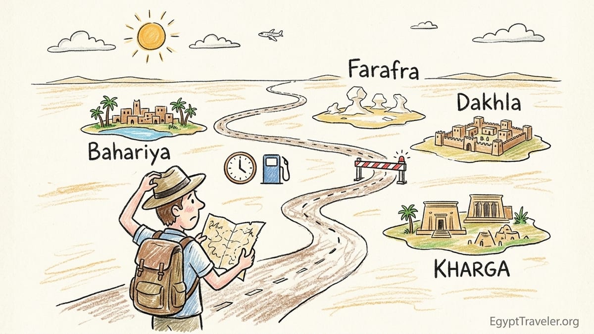
On paper, my plan looked efficient. Start in Cairo, drive to Bahariya, continue to Farafra and the White Desert, then push on through Dakhla and Kharga before dropping back into the Nile Valley at Luxor. It followed what tourism brochures sometimes call the Western Desert circuit between Cairo and Luxor, linking four of the major oases: Bahariya, Farafra, Dakhla and Kharga. I treated them as if they were neighborhoods of one big destination rather than distinct depressions separated by long corridors of rock and sand.
Guidebooks and official tourism PDFs reassured me this was a classic route. One desert brochure outlined Cairo to Bahariya, then Farafra, Dakhla and Kharga as a single adventurous chain, and the national tourism site described a road looping out into the Western Desert and reconnecting with the Nile at Luxor, passing through those oases on the way. That framing shaped my expectations more than I realized. I saw a logical line on a map and assumed days of pleasant drives punctuated by springs, villages and coffee stops.
The reality on the ground is different. Egypt’s Western Desert is a stretch of the Sahara, and the populated oases are literal depressions in that desert. Between them are hours of road with almost nothing built along the way. The country’s own tourism map describes Bahariya, Farafra, Dakhla and Kharga as islands in an “endless expanse of Saharan sand,” a line I shrugged off as marketing language. I should have taken it literally. Each oasis functions much more like a small town separated by rural highway than like adjacent districts of a city.
Because I assumed compactness, I designed an itinerary that stacked drives and sightseeing far too tightly. I underestimated not only distances, but also checkpoint procedures, fuel stops, heat and the fatigue of driving long hours through an environment with very few safety nets. On the first long transfer out of Cairo, I realized my schedule belonged on paper, not on asphalt.
The Itinerary That Tried to Do Everything
The plan, as I originally booked it, ran for six days between Cairo and Luxor. Day one: Cairo to Bahariya. Day two: Bahariya sightseeing, then down to Farafra in time for a sunset wander and a soak in a hot spring. Day three: White Desert camping, then a midday drive toward Dakhla and an afternoon visit to medieval Al Qasr. Day four: Dakhla’s sites in the morning, then continue to Kharga for the Hibis Temple and the early Christian necropolis of Al Bagawat, before a late-evening arrival. Day five: Kharga to Luxor. Day six: collapse beside the Nile and congratulate myself on having “done” the Western Desert oases.
I had seen that Bahariya to Farafra was about 180 kilometers along the desert road, and that Farafra lay roughly 545 to 575 kilometers from Cairo depending on route. One desert driving guide put Cairo to Bahariya at around 350 kilometers, with another 180 kilometers between Bahariya and Farafra. Kharga, in turn, sits several hundred kilometers from the Nile, and sources that cater to independent travelers routinely quote four to five hours of driving between Luxor and Kharga. I used those figures but only as loose reference points, not as hard budget lines around which to build realistic days.
On the map, those numbers translated in my mind to a few neat five-hour stretches, perfectly compatible with half-days of archaeology at either end. What I did not factor in was that most of these roads run through security zones, with checkpoints where passports and permits are examined. Nor did I plan for fuel stops in small, often busy stations, or for the extra time that even minor delays add when you are stringing multiple legs together in a single day. By the time I realized that “five hours” almost always meant six or more from hotel door to hotel door, my carefully stacked schedule was collapsing like mudbrick in a rainstorm.
The itinerary also tried to treat every oasis as a checklist. In Bahariya I wanted to see the Golden Mummies, climb a dune in the Black Desert and linger in palm groves. In Farafra I had the White Desert, a hot spring and a visit to the Badr Museum on my list. Dakhla’s mudbrick town of Al Qasr, nearby rock-cut tombs and spring-fed fields all made the cut. Kharga had Hibis Temple, Bagawat and a side trip to a distant Roman fort. On paper it looked like a rich, layered journey. In practice, the combination of transit and heat stripped away half of what I hoped to do at almost every stop.
Distances, Checkpoints and the Vanishing Day
The illusion fell apart as soon as we left Cairo for Bahariya. Our driver suggested a 7 a.m. departure so that we would clear the city before traffic and the worst heat. Even so, the drive took nearly six hours with a quick roadside tea break and a fuel stop. Somewhere around the halfway point the urban sprawl fell away and the road ran between beige flats of gravel that seemed to stretch to the horizon. There were long periods without any building in sight. It was beautiful but disorienting, and it made the distance feel much more absolute than its number of kilometers.
To continue to Farafra the following day, we had to repeat that pattern. Bahariya to Farafra is roughly 180 kilometers along the desert road, a figure confirmed by guides to the Western Desert oases and by tour operators who specialize in the White Desert. In theory that should be two to three hours of driving. In reality, once you add a short visit to the Black Desert and a stop at Crystal Mountain, the outcrop about 120 kilometers from Farafra along the Bahariya road, plus time at the park entrance for the White Desert, the transfer occupied most of the middle of the day. Our “late morning” arrival in Farafra turned into mid-afternoon, and the town’s famous sulphur spring became an either-or choice with seeing the oasis itself.
Further along the chain, the numbers widened. Depending on the exact start and end points, Farafra to Dakhla is roughly 300 kilometers of desert road, and Dakhla to Kharga another 200 or so, with only sparse facilities between settlements. Egyptian government distance tables give Cairo to Farafra at around 576 kilometers by road and Cairo to Kharga at close to 600 kilometers. A Kharga travel guide aimed at independent visitors notes that Kharga to Luxor is commonly a four to five hour drive, even without scheduled bus services. Those bare numbers do not reflect time at checkpoints or delays if a convoy is being formed, and they definitely do not capture the kind of fatigue that grows over hours of unfenced desert highway.
What surprised me most was how skinny each day became once I subtracted transit and logistics. On our longest run, a morning drive from a campsite in the White Desert back toward the highway and down to Dakhla, we were on the move or waiting at barriers from 6:30 a.m. until nearly 2 p.m. Lunch, check-in and a short rest in Mut, Dakhla’s main town, took us to 4 p.m. That left barely two usable hours of light for sightseeing before dusk. My notes for the day have a single line under “Al Qasr”: “Beautiful but rushed, too tired to climb side alleys.” The distances did not look impossible. It was the cumulative friction of checkpoints, fuel, food and heat that made them so.
Heat, Weak Phone Coverage and Sparse Facilities
If I had planned this trip for spring or late autumn, my mistakes might have been more forgiving. Instead, I went in late May as temperatures were shifting decisively into summer. In Bahariya and Farafra early afternoons routinely hovered above 38 degrees Celsius, and several locals remarked that July and August would be hotter still. Official climate descriptions for the New Valley region, which includes Kharga and Dakhla, talk about humidity dropping below ten percent for much of the year and winter sunshine drawing health tourists. In late May, that dryness translates into heat that feels relentless by midday, even if mornings are pleasant.
The impact on sightseeing was immediate. I had scheduled site visits for mid-morning and early afternoon, treating the oases a little like the Nile Valley where you can often find shade, cafes and air-conditioned museums between temples. Out in the Western Desert, many of the most interesting places are unsheltered. The White Desert, the volcanic hills of the Black Desert and the mudbrick streets of Al Qasr all involve walking in full sun. By the time the thermometer crept above the mid-30s, our stamina fell off a cliff. We cut walks short, skipped side trails and reached a point one day in Dakhla where the strongest appeal of a hot spring was the shade of the palm trees around it, not the water itself.
Weak mobile coverage magnified the sense of exposure. networks reach the main towns and some stretches of highway, but there were long gaps in which my phone showed only emergency call capability. Between Bahariya and Farafra, then again between Farafra and Dakhla, I often went an hour or more without signal. That is not unusual for desert roads, but I had grown used to being able to quickly check maps, confirm opening hours or contact a hotel. On this route those basic planning tools were not always available. When our driver suggested a detour around a section of resurfacing near Dakhla, I had to rely entirely on his knowledge. I could not cross-check on a live map or message the guesthouse to say we would be late.
Facilities between settlements were sparser than I expected. There are fuel stations in the main oases, but along the inter-oasis roads services appear in clumps. On one stretch south of Bahariya we passed a simple roadside cafe and then drove nearly two hours before seeing another. Restrooms tended to be basic, snacks limited and drinking water not always refrigerated. None of that is a problem if you expect it and stock up, but I had counted on being able to improvise coffee stops and cold drinks every hour or two. That assumption belonged to my experience of European and North American highways, not to a network of desert roads built to connect small population centers separated by hundreds of kilometers of inhospitable land.
Cash, Fuel and the Day the Plan Fell Apart
My most painful lesson came on the day we tried to combine Dakhla’s main sights with the drive to Kharga. The plan was ambitious but, I thought, reasonable: a morning in Al Qasr, a quick lunch, then three hours south-east to Kharga for a late-afternoon visit to Hibis Temple and the nearby Bagawat necropolis. We would sleep in Kharga and continue to Luxor the following day. I had read that Kharga, as the capital of New Valley Governorate, had banks and ATMs, so I was relaxed about money. I expected to be able to pay the driver in a mix of cash and card, topping up local currency there.
We left Mut around 8 a.m., reached Al Qasr in lovely soft light and began wandering its covered alleys and crumbling houses. It is one of the most atmospheric mudbrick towns in Egypt, and it was hard to leave after less than two hours. Already we were behind schedule. A late breakfast of fuul and tea with our guide nudged us toward midday before we even left Dakhla. At a police checkpoint outside town the officer wanted to see both our passports and copies of our permits for the White Desert, even though we had already exited the protected area the day before. The exchange was polite but slow. By the time we were cleared to continue, the sun was high and the heat thick.
About halfway to Kharga we stopped for fuel at a busy station that was temporarily serving vehicles from a construction project along the road. There was one functioning pump, a small queue and no card payment. At that point, with the next major town still far off, there was no choice but to join the line. When I asked about an ATM in the village, the woman at the attached kiosk shrugged and pointed back toward Dakhla. In my eagerness to keep the itinerary light, I had not withdrawn extra cash the night before. The driver fronted the fuel payment, but it meant pooling what cash we had until we found a bank.
We rolled into Kharga in the late afternoon, tired and gritty, and drove straight to Hibis Temple. The guard at the gate explained that the site had closed early because the team on duty was short-staffed in the heat. Bagawat, next door, was also shutting. Both were willing to let us walk to the fence line and look from outside, but a meaningful visit would have to wait until morning. The tightly packed day I had pencilled in for Dakhla and Kharga had been hollowed out by accumulated delays and by my failure to schedule any slack. That evening, counting a dwindling stack of notes in our guesthouse and wondering whether the ATM in town would accept foreign cards, I finally accepted that I had tried to compress a week’s worth of desert time into a few rushed days.
Early Starts, Tired Evenings and the Myth of “Seeing It All”
Once it became clear that heat would dictate our rhythm, our days shifted earlier. In Bahariya and Farafra, guides recommended setting out just after sunrise for dune walks or White Desert excursions, returning to shade by late morning. On the long transfers toward Dakhla and Kharga, drivers suggested 6 a.m. departures to make the most of cooler hours. That worked in theory, but in practice it meant short nights of sleep. After evening meals in small local restaurants or at guesthouses, there was planning to do, bottles to refill and photographs to back up. By the third day I felt as if every dawn start was borrowing against a sleep debt that I could not repay.
The result was a kind of sandblasted fatigue that made even modest goals feel heavy. On paper, spending an hour among the chalk formations of the White Desert and another at a hot spring in Farafra sounds gentle. In reality, after two consecutive pre-dawn wake-ups and hundreds of kilometers of driving, both involved effort. I remember leaning against a rock in the White Desert, the chalk crunching under my boots, and realizing that my attention was blurring. I was looking at one of the most striking landscapes in Egypt, a protected area of wind-sculpted forms that many visitors rank as the highlight of their trip, and yet a part of me wanted nothing more than a cool, dark room.
Stacking archaeological sites made things worse. In Bahariya we toured tombs and a small museum of mummies. In Dakhla it was rock-cut tombs and an old mosque. By the time we reached Kharga I had Hibis Temple and Bagawat queued up behind weeks of Nile Valley monuments in my memory. The Western Desert sites are historically rich, but in a schedule that treated them as boxes to tick, they blurred into one another. I would have appreciated half as many more deeply. Instead, my notes are full of comments like “lovely but rushed” and “would have lingered if cooler.”
Evenings, which I had imagined as relaxed times in palm gardens or hot springs, often vanished into logistics. Without reliable daytime phone coverage on the roads, questions about the next day’s route and permits had to be sorted out in person after arrival. We found ourselves huddled over paper maps with drivers, discussing whether a side trip to a remote fort was feasible or whether roadworks would slow us down. Desert guides talked about permit offices in Bahariya and Farafra, security updates along the border and seasonal closures. None of that information fit into the simple itinerary template I had copied from a glossy brochure. It belonged to a slower, more adaptive form of travel.
The Lesson: Fewer Oases, More Time in Each
By the time we reached Luxor, I no longer felt proud of having linked four oases in one sweep. I felt lucky that nothing serious had gone wrong. The Western Desert is not a hostile place if you respect it. Roads are paved, local people are generous and knowledgeable, and licensed operators run excellent desert camps. But the geography does not reward travelers who try to sprint. Each oasis is a distinct depression with its own microculture, landscapes and history. Treating them as bullet points on a “Cairo to Luxor the hard way” list does them, and you, a disservice.
The critical lesson for me was not that the oases are inconvenient or too remote. It was that they open up when you give them time. In Bahariya, an extra day would have meant wandering through date groves, talking to local farmers and soaking properly in a hot spring instead of peering at it between transfers. In Farafra, two nights would have allowed a full afternoon in the White Desert, a slow visit to the small mudbrick village and an unhurried evening at a sulphur well. In Dakhla, a lingering morning coffee in Al Qasr and an afternoon walk among fields would have replaced the rush-hour sprint we endured.
Slowing down also changes your relationship to risk. With more nights in each oasis, there is room for inevitable delays. A fuel queue, a longer-than-expected checkpoint inspection or an attraction closing early for heat or staffing does not wreck your day if you are not scheduled to drive another 250 kilometers afterward. You can shift visits to early morning or late afternoon, rest at midday and respond to local advice about which sites are open, which roads are resurfaced and which springs are quiet that week.
Perhaps most importantly, a slower itinerary aligns with how locals themselves experience the desert. Guides in both Bahariya and Farafra talked about seasons, wind patterns and the way light changes the same dune over a single day. None of that reveals itself from the window of a vehicle. It emerges when you stay long enough to see the same palm grove at dawn, noon and dusk, or when you spend two nights in a small hotel courtyard, watching who passes through. The Western Desert is not just a corridor between Cairo and Luxor. It is a region with its own pace.
The Route I Would Choose Now
If I were planning the trip again, I would give myself at least eight to ten days between Cairo and Luxor and resist the urge to collect every oasis in one go. Instead of a thin line of one-night stops, I would design a route with more two-night bases, fewer archaeological sites per day and a full recovery day after any night of desert camping.
The new plan would start with Cairo to Bahariya as before, but with two nights in Bahariya. Day one would be the long drive, with no expectations beyond arriving before sunset, stretching legs in a palm grove and arranging permits with a local operator. Day two would be a loop: a morning excursion to the Black Desert and nearby viewpoints, then a lazy afternoon visiting a single set of tombs or the local museum, with time for a sunset soak in a hot spring. No onward driving that day, no ticking off every named site.
From Bahariya I would still go to the White Desert and Farafra, but again with a slower rhythm. A night of camping among the chalk formations would be followed by a short drive into Farafra and a second night there. That would allow the camping experience to breathe, with a late breakfast and time to rest before wandering the oasis in the late afternoon. A visit to a sulphur spring or to a small local museum could be the only formal “sight” that day. Crucially, the long transfer toward Dakhla would move to the following morning, so that fatigue from the night under the stars does not meet a demanding drive.
In Dakhla and Kharga I would choose depth over breadth. One option would be to spend three nights divided between the two, perhaps two in Dakhla and one in Kharga. In Dakhla that would mean a focused morning in Al Qasr, an afternoon among fields or in a hot spring, and a second day kept intentionally light, with maybe one additional archaeological site or a short excursion to a nearby rock-cut tomb. Only after that would I plan the road to Kharga, leaving early enough to arrive by mid-afternoon, with the rest of the day reserved for Hibis Temple and Bagawat if they are open. If not, I would have the following morning in reserve rather than trying to squeeze everything into a single, fragile window.
Finally, I would block out a complete rest day in Luxor at the end of the circuit, not as a chance to rush into more temples but as recovery from the desert. The Western Desert oases reward travelers who treat them as destinations in their own right rather than as an alternative highway between big-name Nile cities. A redesigned route with more two-night stays, fewer daily targets and built-in slack would not guarantee perfection. Desert weather, roadworks and bureaucracy have their own ideas. But it would align much more closely with the realities of distance, heat and logistics that I learned, the hard way, on my first too-ambitious attempt.
The Takeaway
Looking back, what I misjudged most about Egypt’s Western Desert was not a specific distance or drive time. It was the nature of travel in a landscape where populated oases sit as true islands in a sea of sand. Bahariya, Farafra, Dakhla and Kharga are not stops on a commuter line. They are separate depressions, each several hours of desert road apart, with sparse facilities and a climate that shapes every hour of the day.
The critical lesson from my trip is simple. These oases are not inconvenient. They are generous, beautiful and deeply rewarding, but only if you stop trying to conquer them in a sprint. Underestimate the heat and you will find your sightseeing stamina evaporating by late morning. Underestimate the distances and the cumulative drag of checkpoints, fuel stops, weak phone coverage and occasional attraction closures, and your neatly packed itinerary will unravel. Plan for fewer moves, more two-night stays, fewer archaeological sites per day and a true rest after any night of desert camping, and the Western Desert will feel like a place you are living in for a while rather than a series of road segments you are trying to finish.
If my first circuit taught me anything, it is that the Western Desert oases belong on a different mental map than Cairo or Luxor. They resist being rushed, and they repay patience many times over. The best itinerary is not the one that plots the most dots across the sand, but the one that gives each oasis enough space for its character and its quiet to emerge.
FAQ
Q1. Is it realistic to visit Bahariya, Farafra, Dakhla and Kharga in one week?
It is technically possible to drive the full circuit in a week, but most travelers will find that pace too rushed. A more comfortable plan allows eight to ten days between Cairo and Luxor, with at least two nights in Bahariya or Farafra and two or three nights divided between Dakhla and Kharga. That gives you time for delays, early starts and rest after desert camping.
Q2. How long are the drives between the main Western Desert oases?
Approximate road distances are helpful for planning: Cairo to Bahariya is around 350 kilometers, Bahariya to Farafra about 180 kilometers, and Cairo to Farafra roughly 545 to 575 kilometers depending on route. Farafra to Dakhla and Dakhla to Kharga each involve several hundred kilometers of desert road, and Kharga to Luxor is usually quoted as a four to five hour drive. Always add extra time for checkpoints, fuel stops and breaks.
Q3. How hot does it get in Egypt’s Western Desert, and when is the best time to go?
Summer temperatures in the Western Desert can exceed 40 degrees Celsius in the middle of the day, with very low humidity. Sightseeing in open sites such as the White Desert or mudbrick old towns becomes challenging by late morning. Most travelers prefer October to April, when daytime temperatures are milder and you can comfortably explore outside for longer periods.
Q4. Are there enough fuel stations and rest stops between oases?
Fuel is available in the main oases, but stations along the inter-oasis roads are limited and sometimes busy with commercial traffic. Basic roadside cafes and small shops appear at intervals, yet you should not assume frequent services. It is wise to start each long leg with a full tank, carry extra drinking water and snacks, and ask local drivers where the last reliable fuel stop lies before a long segment.
Q5. How reliable is mobile phone coverage in the Western Desert?
Coverage is generally good in the main towns but inconsistent on the roads between them. It is common to lose signal for long stretches between Bahariya and Farafra or between Farafra and Dakhla. You should download offline maps, keep important booking details saved locally and plan to confirm arrangements in person when you arrive at each oasis rather than relying on last-minute calls from the road.
Q6. Do I need permits or a guide to visit the White Desert and surrounding areas?
Access to the White Desert and some protected or border-adjacent areas requires permits that are usually arranged by licensed local operators. Many travelers choose to join organized overnight camping trips that include permits, equipment and guides. For safety and bureaucracy reasons, independent travel into remote desert zones without local support is not recommended, even if the highway itself can be driven without a guide.
Q7. How should I plan cash and card use on a Western Desert trip?
ATMs and card payments are more common in larger towns and in parts of Bahariya and Kharga, but smaller guesthouses, cafes and fuel stations may prefer or require cash. Withdraw a comfortable amount of Egyptian pounds before leaving major cities and top up in larger oases when you can. On days with long drives, assume you might need cash for fuel, snacks and tips in places where cards are not accepted and ATMs are scarce.
Q8. What is a realistic amount of sightseeing per day in the heat?
In hotter months, plan for one major outdoor activity in the early morning and perhaps a lighter visit late in the afternoon, with rest or shaded time in the middle of the day. Trying to stack several archaeological sites or long walks into a single day will leave you exhausted and less able to appreciate what you see. In cooler seasons you may manage a bit more, but even then it is wise to leave space in the schedule.
Q9. Is it safe to drive between the oases as an independent traveler?
Paved roads connect the main oases, and many travelers use private cars or hired drivers to move between them. However, you should be prepared for security checkpoints, limited services and periods of weak phone signal. For desert tracks and protected areas such as the White Desert, local guides and appropriate vehicles are strongly recommended. Before setting out, check current government travel advice and consult local operators about any route-specific restrictions.
Q10. How would you summarize the ideal pace for a Western Desert itinerary?
The ideal pace is slower than many first-time visitors expect. Aim for multiple nights in each oasis, keep driving days focused on the journey rather than sightseeing, schedule only one or two key visits per day, and allow a full day of rest after nights spent camping in the desert. Approached at that rhythm, the Western Desert feels less like a challenge to overcome and more like a landscape you are genuinely inhabiting for a while.